Interested in Lewiston/Auburn’s history and relationship with the Androscoggin River? Looking for an opportunity to get some fresh air, exercise and see the area all at the same time? Then download ALT’s Travelstorys app! This multi-sensory tour (available in a walking version and a paddling version) is a great way to learn about the rich history of the area and the remarkable recovery of the Androscoggin River in recent decades. The Androscoggin River is now a central feature that is enjoyed by both cities. ALT developed this app to help further community engagement with the river. Our mission is to encourage L/A residents and beyond to take advantage of the amazing recreational and educational opportunities provided by the river, as well as the rich and inextricably linked histories of Lewiston and Auburn. The tour takes about 45 minutes to complete. Bring your smartphone down to the river and check it out! For more information about the app’s development process, visit this page.
The app uses geotags and location services on your phone to determine where you are on the Riverwalk, and tells you about what you’re seeing right in front of you. This useful feature lets you take the tour at your own pace–you can even access it remotely, and “walk” the route from wherever you want!
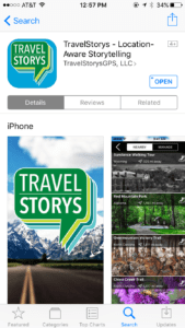
Step One: Download the app in the iTunes or Android app store.
Step Two: Pick your tour. Travelstorys offers two L/A tours: one walking and one paddling. Each covers a unique set of historical information—we recommend that you do them both!
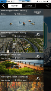
Step Three: Pick a starting spot. The app has suggestions for both tours. Follow their suggestions, or pick your own! The app recognizes your location using geotags, and will bring up the text and audio for wherever the nearest information attraction is.
Step Four: Walk, paddle, listen, and enjoy!
If you’re having trouble with the app, make sure that your audio is turned up and that you have allowed the app’s location services to access your information. For more troubleshooting information, click here.

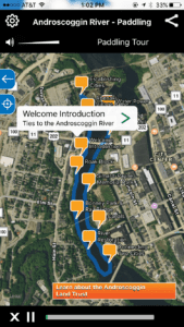
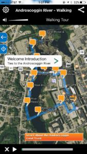
The narration will be triggered at any of the GPS points, but here is a suggested route:
-Start by overlooking the falls at West Pitch Park. Once you are standing at the fence that overlooks the river, open the app and start the tour.
-Walk down the hill via the path that takes you toward the Hilton Garden Inn
-Walk past the Hilton Garden Inn on your right and follow the path that takes you to Broad Street
-Walk across the left sidewalk of the bridge
-When you get to the light on the other side of the bridge, use the pedestrian crossing signal and cross the street
-Continue to walk uphill on Broad Street/Main Street
-Take your next right onto Mill Street
-Follow Mill Street past Baxter Brewing, past the tall brick smokestack on your right, under a sky walk, past DaVinci’s Restaurant until you reach Chestnut Street.
-Take a right on Chestnut Street until you reach Lincoln Street.
-Take a right on Lincoln Street.
-Cross Lincoln Street via the next crosswalk and continue to the right to walk across Beech Street
-Turn left shortly after Beech Street to walk the wavy cement path between Rail’s Restaurant and Lewiston House of Pizza
-Follow this path along the edge of Simard Payne Park (a large grass covered park where annual events such as the Great Falls Balloon Festival occur) and then directly across the pedestrian bridge
-Once you have crossed the river, take a right and follow the paved sidewalk so that the River is now on your right. The tour ends when the bridge that you crossed at the beginning of the tour is directly in front of/above you (you can look up across the bridge to see where you started at West Pitch Park) and you reach the porch at Gritty’s Pub.